


Backroad Mapbooks
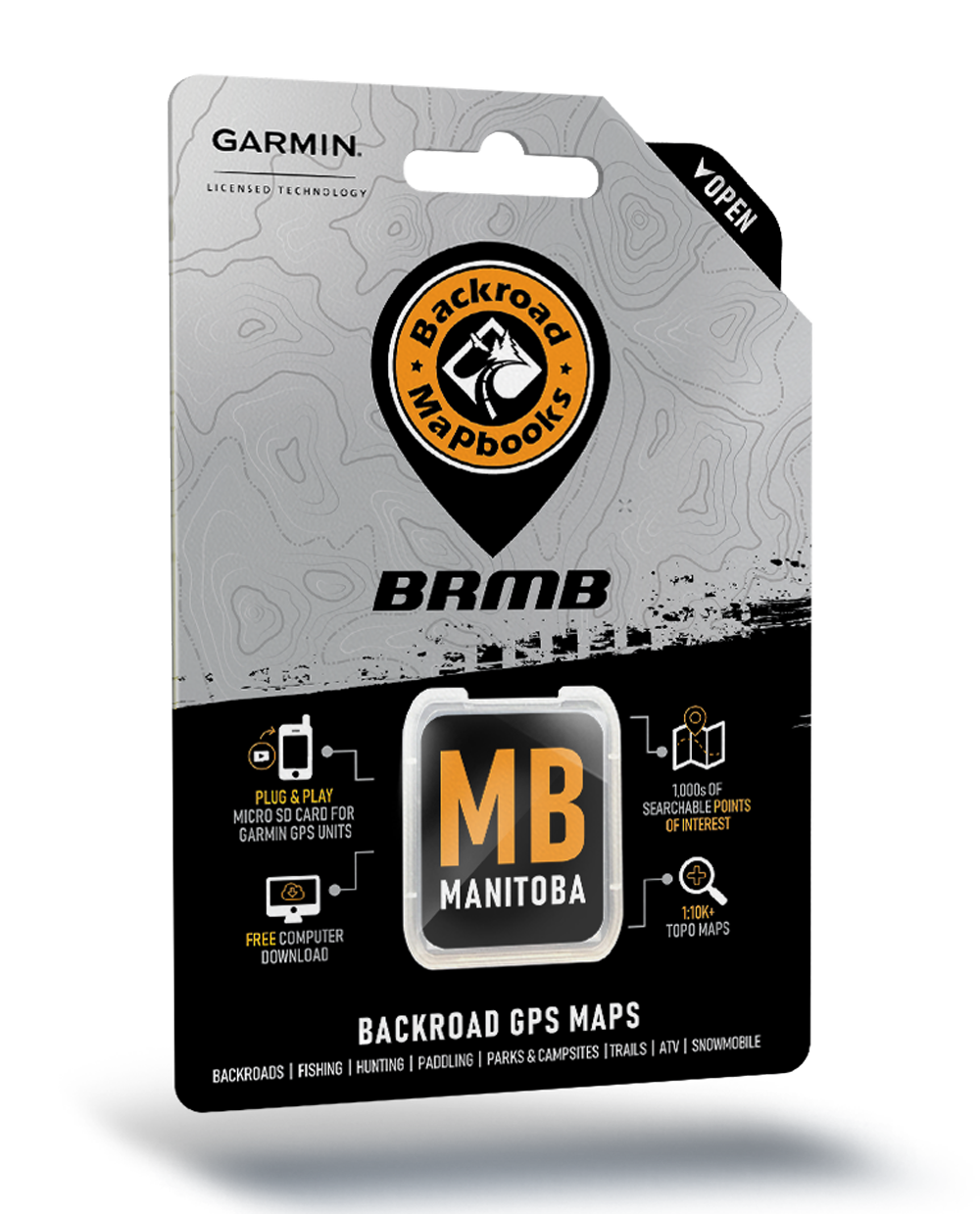
Backroad Mapbooks GPS Maps - SD Card Manitoba
Backroad Mapbooks GPS Maps - SD Card Manitoba
Couldn't load pickup availability
Manitoba
Be Your Own Guide with Version 2020 GPS Maps for Manitoba!
From the sprawling prairie to the pine forest, ancient Canadian Shield rock, Arctic tundra and more than 100,000 lakes, there is lots to discover in Manitoba’s great outdoors. From fishing to hunting, hiking, camping, ATVing, snowmobiling, wildlife viewing and beyond, let our GPS Maps guide you on your Manitoba adventure.
What’s New in Version 2020:
- BRMB GPS Maps are compatible with the new Garmin 66i unit with inReach technology
- Enhanced our Routable Roads with 1,000+ km of improvements to our backroad network
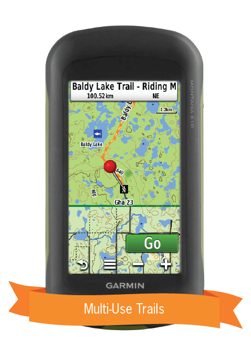
- Added 120+ km of Multi-Use Trails including 75+ new trailheads
- Added close to 50 km of motorized trails for ATV’s and Snowmobiles
- Enhanced our long distance Paddling Routes network including 110 new access and portage locations
- Added 275+ new Backcountry and Canoe Campsites
- Added 65 new Fishing Lakes, Rivers and Streams
- Enhanced our Provincial, National and Urban Parks including 25+ new Huts/Shelters and Day Use/Picnic Areas
- Added close to 25 new Backroad Attractions including historical sites and points of interest
- Added 30+ new Winter Recreation adventures for cross-country skiing and snowshoeing
- Added thousands of mile markers along Railway Corridors
- Enhanced the Snowmobile Route cartography for improved display
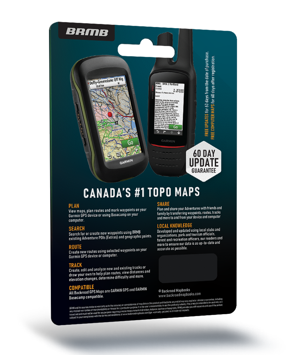
So Much More Than Just Maps!
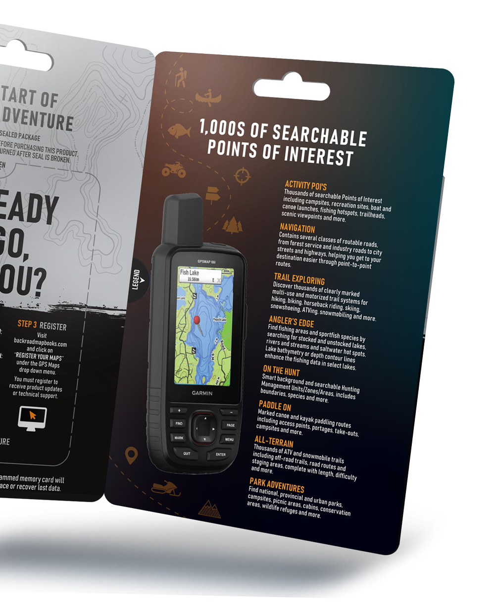
Backroad Mapbooks’ industry-leading topographic maps are trusted by recreationists and industry workers alike, and are even the maps of choice for search and rescue organizations. Also included in the GPS Maps are detailed written descriptions of hunting areas, fishing lakes and rivers, national and provincial parks, wildlife viewing areas, multi-use trails and more. Carefully compiled by our team of outdoor writers and researches, these descriptions include information on access, regulations, difficulty, species and more. With thousands of adventures to take on including hiking, camping, ATVing, snowmobiling, canoeing and kayaking, the only problem you will have is deciding where to go first.
Manitoba GPS Map Features:
- Over 1.2 million searchable Oil and Gas Township Section and Quarter Section Grid locations
- Over 60 MB Game Hunting Areas (GHA) for hunters
- Fishing Lakes and Rivers with over 640 locations with descriptions and fish species
- Over 80 Boat Launch locations
- Over 140,000 km of our backroads network combined into one map, including over 92,500 km of routable roads
- Over 430 Trails with front country and backcountry locations and descriptions, or close to 4,000 km of trails in total
- ATV Trails with close to 50 trailhead locations and descriptions, or 1,600+ km of trails in total
- Snowmobile Trails with over 90 trailhead locations and descriptions, or 14,600+ km of trails in total
- Parks with over 420 National, Provincial and Regional Park locations and descriptions
- Over 600 Backcountry campsites
- Over 180 Campground and Picnic locations
- Over 1,500 paddling route access points descriptions and portage locations
- Wildlife Viewing with close to 150 locations and descriptions
- Over 150 Winter Recreation Sites and Downhill Ski Areas
- Over 1,400 City, Town and Community locations
- Close to 14,000 searchable land and water geographic features
- Over 170 Backcountry Huts and Cabins
- Garmin-licensed & compatible with Garmin GPS™, Basecamp™, MapSource™ and RoadTrip™.
- Includes all standard Garmin features such as Find tool, city navigation and more.
- Preloaded 1:20,000 / 1:50,000 base scale seamless topographic maps.
- Provides 3D views and the highest level of map detail available on select Garmin GPS units and Basecamp™.